Mistall - Setup & Functionality
Overview
Mistall is a service that is used to count cars in a physical lot, using cameras to track vehicles as they enter and exit the lot.
Within the OPSCOM system, each Mistall lot is associated to a Lot Group.
Mistall Credentials
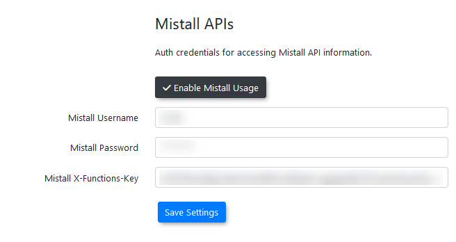
Mistall credentials need to be entered in system settings under third-party settings to be able to use the API.
Credentials are provided to the the client by Mistall itself.
Lot Groups
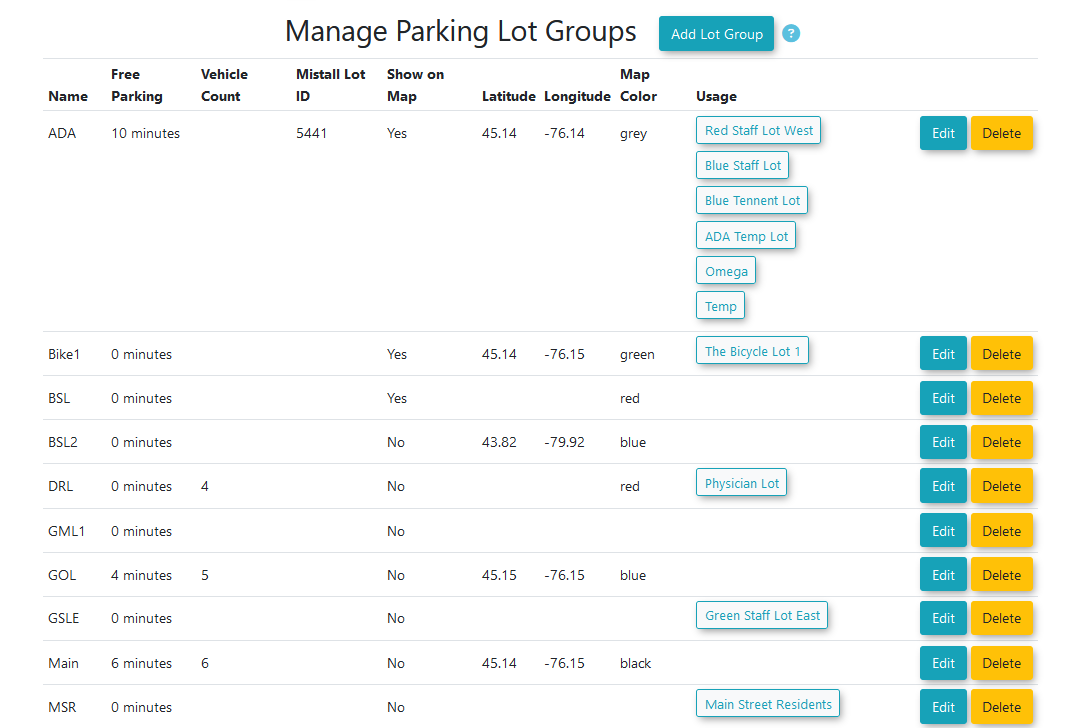
The Lot Groups page was updated to accommodate the use of Mistall.
In addition, Lot Groups have replaced the use of Lots on the Real-Time map on both the admin and user sides.
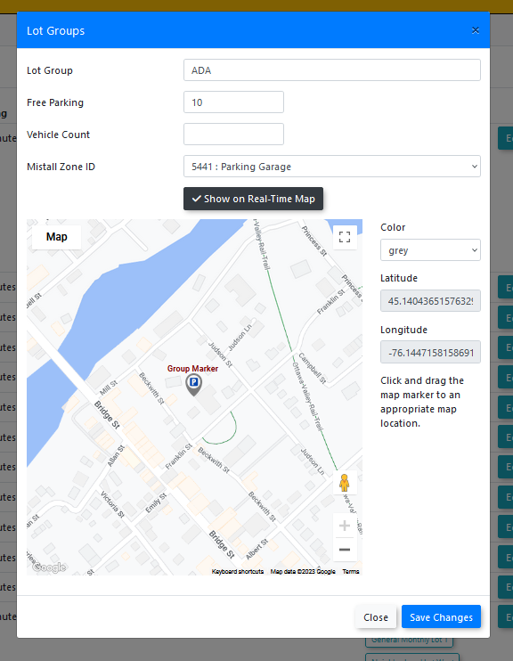
To have data populate the Mistall Lot ID dropdown, the Update Mistall System Job Task must be run at least once to import the data into the system.
Columns have been added for setup with the Real-Time Map and Mistall data. These are the following fields.
-
Map color - map icon color
-
Latitude and longitude - location on the map, selected by putting a point on the map
-
Show on Real-Time map - Select if the group will appear on the real-time map
-
Mistall Lot ID - which Mistall lot the Lot Group correlates to (Supplied by Mistall)
Lot Edit
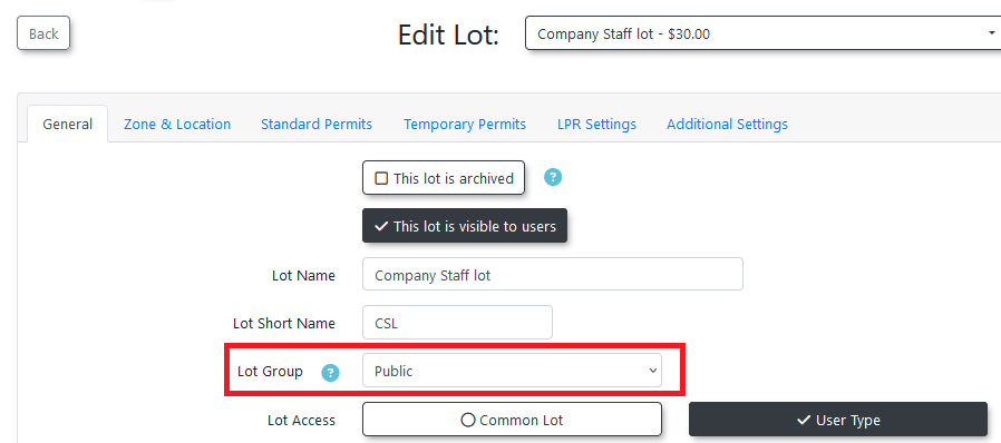
This group must be associated to the lots you wish to configure for Mistall use. In the lot editor on the General tab, you will find the Lot Group Field. select the associated Lot Group from the drop down.
Note: This field to set the lot group has been moved from the LPR section to this General section. This is to allow clients who are not using the LPR system to still use the real-time map features.
Dashboard Widget
The imported Mistall data can be displayed on the dashboard in a widget.
The widget is named mistall-lot-stats.
If the system setting for Enable Mistall Usage is not enabled, this widget will not appear in the edit dashboard page.
The widget shows the raw Mistall data. The names of the lot groups associated to the data will be shown beside the bar chart.
Note: If the Mistall data is not yet associated to a lot group, it will show the Mistall lot name instead. This is the name given to the lot by Mistall.
Real-Time Maps
The admin and user-side real-time maps have been updated to use lot groups in additional to the individual lots as pins on the map.
The functionality of the maps is not dependent on the use of Mistall in a system.
If your system doesn’t have the Mistall integration enabled, the lot groups will use the data of the associated lots in place of Mistall data for the real-time maps.
Admin-Side Map
The admin map has been updated to use lot groups.
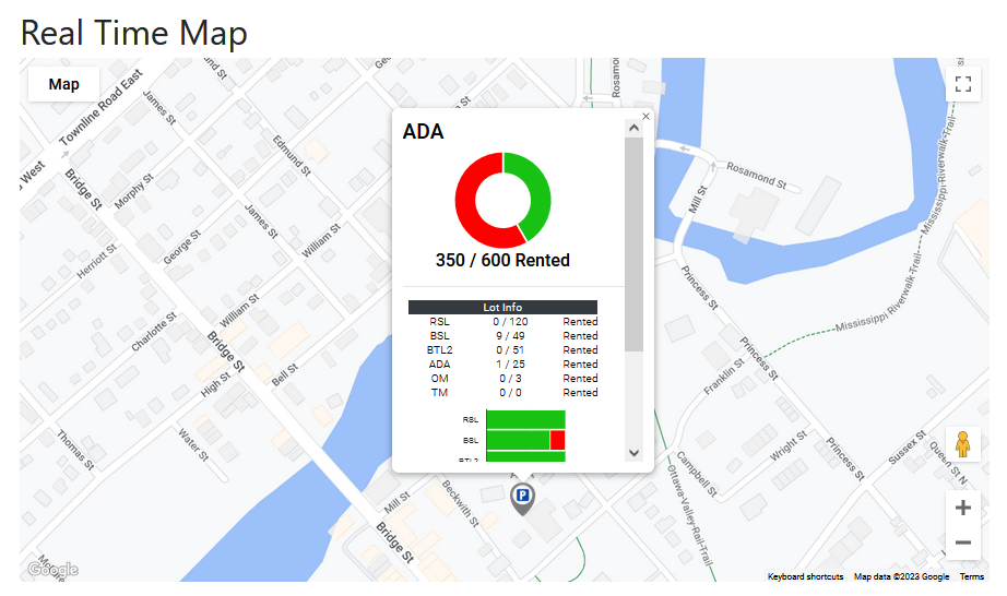
When a lot group is clicked on, it will show the new popup.
Note: If the lot group has no Mistall data associated to it, it will use the collated counts of the lot info below instead.
If Mistall data is being used for the lot, it is likely it will not match the counts shown in the lot info window below. It is intentional that the information will not match.
The intention is that the client will be able to see the difference between what is physically present in the physical lot (lot group Mistall stats) and what the permits purchased within the system look like in comparison.
For example, if the lot is physically empty but is maxed out on purchased permits, the number of available permits can be increased for that lot.
User-Side Map
The user-side map has also been updated to use lot groups.
As before, the user map is made to appear by placing the shortcode on a client-created page.
There are two shortcodes available to use for the real-time map.
[real-time-map] - Displays the actual map.
[real-time-legend] - Displays a legend explaining the color coding used in the map.
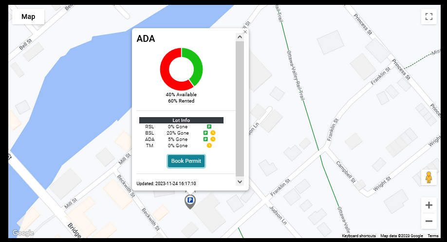
The user-side map will now appear like this:
The donut graph at the top shows the Mistall data if it is present. If the lot group does not have an associated Mistall lot, it will show the collated counts of the lot info below.
The lot info shown below the donut graph is from the permit counts in the system.
Unlike the admin-side map, the information here is presented as a percentage instead of the actual numbers. This is to allow for some leeway for any inaccuracy.
The icons to the right display if the lot allows standard or temporary permits.
-
Green is standard.
-
Yellow is temp.
The map should be accessible for Guest Users who are not logged in. If the user is logged in, they will be able to see standard permits and temp permits, but if they are not logged in, they will only be able to see temp permits.
The book permit button now takes the user to a new page used for selecting a permit from within the selected lot group.
User-Side Lot Group Page
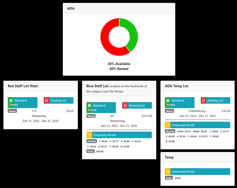
The lot group page shows much the same data as the regular permit page, just with the data specific to the selected lot group.
At the top of the page, the same donut graph from the pop-up window on the map is shown, displaying a percentage of availability. It is calculated from the Mistall data or the lots below if there is no Mistall data for the lot group.
The lots are shown below. If the user is a guest (not logged in), they will only be able to see temporary permits on the page.
The standard permit booking button will take the user to the regular standard permit booking page, but the temporary permit booking button will take the user to the quick checkout.
This is the checkout used for QR codes and the old version of the map. It allows the user to purchase the permit and checkout immediately without adding it to their cart.

